top of page

Old Maps of Goadby Marwood

Ordnance Survey late 19th Century

Framland Hundred c. 1795

Ordnance Survey mid-20th Century

Saxton's Map of Leicestershire 1602

Bestwood and Staveley Iron Companies Quarry Map
mid-20th Century
.jpg)
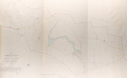
Tithe Survey Map 1839

Valuation Survey Map 1910
.jpg)
1920 Belvoir Estate Sale Plan No. 13 (Goadby Marwood area only)

1920 Belvoir Estate Sale Plan No. 7

Map of Goadby estate by Thomas Crane 1715
bottom of page